
GPS substitutes: there is no system capable of completely replacing satellite geolocation
As Department of Defense concern grows over adversaries' growing ability to jam GPS satellite signals , experts warn that there is no one-size-fits-all alternative to meet military needs for positioning, navigation, and timing (PNT) capabilities.
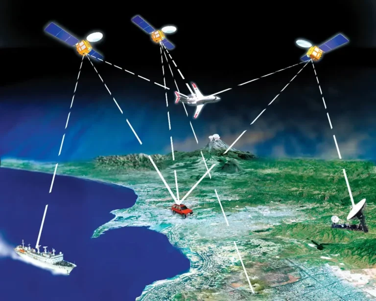
Radio frequency (RF) signals transmitted by Global Positioning System satellites can be used by a wide variety of platforms for a nearly infinite number of military missions – from helping a soldier drive an all-terrain vehicle in an unfamiliar landscape to driving a missile flying towards its target.
The problem, as is demonstrated every day in conflict zones like Ukraine and Gaza, is that RF GPS signals are weak and easily jammed – or, perhaps worse, spoofed to trick users into going or looking in the wrong place. For example, in March a plane carrying British Defense Minister Grant Shapps from Poland to Britain lost GPS near Kaliningrad due to a suspected Russian jamming – something his spokesman said was not unusual on the Baltic coast of Russia.
“It's a real-world problem,” Michael Monteleone, director of the Army Futures Command's new Cross-Functional Full-Domain Sensing Team (CFT), said during a May 5 panel at the U.S. Geospatial Intelligence Foundation's annual GEOINT conference in Kissimmee, Florida.
So the Pentagon, Space Force, Army and other military services have been scrambling to find alternatives for when (not if) GPS stops working on the battlefield.
The difficulty, however, is that every technique available now or in the foreseeable future for what is often called 'alt-PNT' involves the need to make trade-offs in terms of size, weight, power and cost. , depending on the type of platform used and the nature of the mission duration, according to experts.
Lloyd Dabbs, director of public sector business development for SandboxAQ, explained during the GEOIN panel that the Pentagon will need a “holistic strategy” to develop methods to create “a good composite signal” provided by combining different techniques. “Nothing will ever replace GPS” admitting that this system is not replaceable in any case.
“There is no silver bullet,” Nikki Markiel, senior GEOINT authority for geomatics at the National Geospatial-Intelligence Agency (NGA), told Breaking Defense. “Everyone would like to have one. And I think this is the starting point of many difficulties, because GPS was easy. It is omnipresent." Replacing it will be a big problem
What roads are being taken?
Markiel explained that there are six broad “families” of methodologies for positioning and navigation, based on the type of data used. The good news is that this means there are alternatives. The bad news is that each can provide distinct advantages and disadvantages.
GPS itself is part of the first and most popular method today for determining where you are and where you are going: RF signals. Other countries have developed their own GPS-like RF satellites – such as Europe's Galileo constellation and China's Beidou – which means one of the things the US military could do to provide GPS backup is simply make its receivers compatible with these systems, just as most civilian cell phones already are.
Cell towers and broadcast towers also provide “signals of opportunity,” other types of RF signals that can be leveraged for positioning and synchronization.
According to the expert, however, these systems do not provide particular advantages compared to GPS, because they are still based on radio frequency and therefore susceptible to disturbance. Therefore they are alternative systems, but, at the same time, based on the same principles and less precise than GPS.
A second family of devices is one that relies on using gravity, which is how inertial navigation systems (INS), such as those carried by most military aircraft, work. The drawback of these devices is that they “drift” if they get it wrong and must be corrected by other means, usually GPS. But they cannot be disturbed.
A third methodology for positioning and timing uses “crustal magnetics,” Markiel said. Known as “mag-nav,” the essence of the technique is the use of a magnetometer to measure changes in the Earth's magnetic field. When rock in the Earth's crust solidifies it retains a unique magnetic signature and, based on this characteristic, a map can be created that can be detected using an on-board magnetometer. These systems are excellent at sea, quite precise on land, and, above all, they cannot be disturbed.
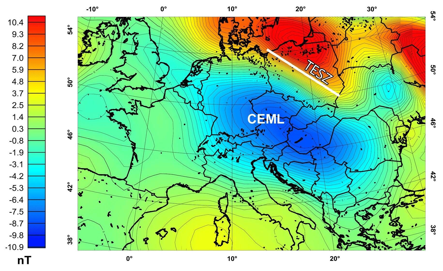
Magnetic map of Central Europe
The problem, in this case, is to collect magnetic data precisely enough to be used in a navigation system.
Celestial navigation is a fourth method, using the positions of the stars and planets as sailors have always done. Markiel noted that some new tricks are being explored for this ancient art, such as using man-made space debris and natural celestial bodies. Even inert space junk in orbit can be used to give an accurate location.
On the other hand, clouds and bad weather – as well as smoke, which is not uncommon on a battlefield – are a curse for this type of navigation.
Likewise, weather and smoke are obstacles for the fifth potential alternative to GPS: remote sensing , essentially “visual navigation” that simply uses landmarks and a paper map.
Using elevation or bathymetry – measuring distance from land or sea – is the sixth method that has been used for decades, but is not available everywhere. .
Active detection systems, with the use of active radar or sonar that detect the position by emitting waves which are then reflected by the ground or coasts , are the seventh system, but this requires energy and can be detected by hostile subjects.
So there will not be a single replacement for GPS, but, at most, a mix of localization systems capable of plugging the lack of data of a disturbed GPS system. However, as we have seen, no system is perfect and each has problems.
![]()
Thanks to our Telegram channel you can stay updated on the publication of new Economic Scenarios articles.
The article GPS substitutes: there is no system capable of completely replacing satellite geolocation comes from Economic Scenarios .
This is a machine translation of a post published on Scenari Economici at the URL https://scenarieconomici.it/sostituti-del-gps-non-esiste-nessun-sistema-in-grado-di-sostituire-completamente-la-geolocalizzazione-satellitare/ on Wed, 15 May 2024 09:00:44 +0000.